ROUTE 29: Errant Signs Still Up at Dupont, But Can They Be Reused at Key Bridge?
IT’S NOW BEEN MORE THAN THREE WEEKS since I started a test of the D.C. government’s social media responsiveness regarding what should be a relatively easy task: Removing incorrect signage from Dupont Circle that suggests Route 29 heads through the District via New Hampshire Avenue.
The signs were still posted as of this morning. (But I did see a DDOT truck full of signs parked on Wisconsin Avenue in Tenleytown earlier today, so maybe it was en route to deal with my request?)
As I detailed recently on this blog (and in a January 2005 blog post when I was editing DCist), Route 29 was rerouted years ago, via 11th Street NW and Rhode Island and Georgia avenues. The incorrect signage has been at Dupont Circle for years, so I realize that it’s not the most pressing problem for the District Department of Transportation, which has had a busy winter dealing with blizzards and a subsequent pothole-filling blitz, aided by Twitter. (DDOT was also busy at Nationals Park on Monday with Opening Day.)
I’ll tweet @DDOTDC to check in on my request to remove the incorrect signs and update. (Another quick response, via direct message: @DDOTDC hasn't forgotten about my request, it's just there hasn't been time yet to get them taken down. C'est la vie.) Since the initial tweet request on March 14, the agency acknowledged my request, responded to a second tweet inquiry and confirmed via subsequent direct messages that Route 29 doesn’t run through Dupont Circle. Additionally, @DDOTDC asked me where the signs were located. I responded that there are at least four Route 29 signs if you walk around the circle. (Hey DDOT: I recently spotted a fifth, on New Hampshire Avenue, south of the circle, on the sidewalk adjacent to the northbound lanes and the Heurich House.)
So, What About the Key Bridge/Whitehurst Signs?
 It would a shame to just trash the old Dupont signs. Here’s a suggestion: Reuse them for the Route 29 connection between the Key Bridge and Whitehurst Freeway.
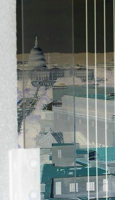
Just like I noted in January 2005, northbound Route 29 today lacks any sort of signage on the Key Bridge to alert drivers to the connecting ramp to the Whitehurst Freeway, where Route 29 continues en route to K Street NW and downtown. (At the photo above, note the small hard-to-see sign that says “To Downtown,” which lacks any sort of arrow indicating which way you’re supposed to go.)
 Similarly, wayfinding signage for southbound Route 29 is problematic. There are no Route 29 signs if you’re going from the Whitehurst onto the Key Bridge, via the bridge’s congested intersection with Canal Road and M Street NW. In the traffic island, there’s a big empty signpost just sitting there (see photo below left), suggesting the city once had plans to place wayfinding signage there for Canal Road/MacArthur Boulevard/Foxhall Road and another for Key Bridge and M Street NW (and southbound Route 29, of course).
 Are U.S. Highway Route Signage Important?
Drivers in the District don’t find much use for U.S. highway routes, which predate the Interstate Highway System. The routes, designated with black lettering on a white shield, are more identified with roadways in Maryland and Virginia. Long-distance drivers generally stick to the Interstate highways and don’t need to rely on Routes 1, 29 and 50 to get move through the D.C. metro area. But they might take one of those routes through the Maryland and Virginia suburbs, though they’re often known better by local names, like Lee Highway (Route 29) or Arlington Boulevard (Route 50) in Virginia and Colesville Road (Route 29) in Maryland.
In recent years, the city replaced aging and ineffective route wayfinding signage on the inbound 14th Street Bridge. The bridge technically carries Interstate 395 and Route 1 between the District and Virginia. As drivers approached the 14th Street SW/Southwest Freeway split adjacent to the Jefferson Memorial, the overhead sign simply gave you two highway shields to choose from: Route 1 and Interstate 395. When the sign was rehabbed a few years ago, additional information was added to note that Route 1 runs into downtown via 14th Street, which is more useful designation for local drivers.
Now, will the District clear up the Route 29 confusion? (I just tweeted @DDOTDC about possibly reusing the signs.)
Labels: d.c., DDOT, dupont circle, key bridge, route 29, signs, whitehurst freeway


