PALISADES DISPATCH: Down in the Gorge
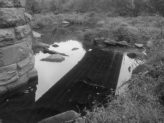
 DURING A LULL on Friday afternoon (once the rain had stopped) I ventured down into the national park lands below my great aunt's house in the Palisades. For years, I've always wanted to go exploring in the boggish, wet, rock-strewn land between the C&O Canal and the Potomac's main river channel, but never got around to it. So I decided to go dowm there. After heading down the Capital Crescent Trail to the C&O Canal towpath and then to a trail near the Chain Bridge, I made my way to the Potomac, which seemed to be running pretty low. But the whole rocky floodplain is quite interesting with all sorts of tiny rivulets, ponds, and rocks thrown about by past floods. It is at this point where the Potomac ceases to be navigable, marked by the first cataract at Little Falls slightly upriver. (Remember, this is still within the boundaries of the District of Columbia.)
 THE CHAIN BRIDGE itself is quite interesting. I came across some historic graffiti from 1889 scratched into one of the bridge piers. I can't seem to find any easily accessible history of the Chain Bridge, but I think it's been around for probably 150 years or so. During the Civil War, the bridge was well protected. Across from my great aunt's house on the thin greenbelt between the street and the actual palisades of the Palisades, you can see the remains of old Civil War-era artillery earthworks (click here to see an 1861 illustration of the Chain Bridge defenses from Harpers Weekly.) that guarded the heights above the bridge. (Fort Marcy is opposite on the Virginia side, where Vince Foster infamously took his own life in July 1993.)
In another historic note, there was a grist mill on the Virginia side of the Chain Bridge at Pimmit Run. In 1814 when the British were having their way with the young capital, the Declaration of Independence was hidden at the mill in flour sacks, according to this write-up
I took a bunch of photos (including this one here), which are posted over on Flickr.


0 Comments:
Post a Comment
<< Home